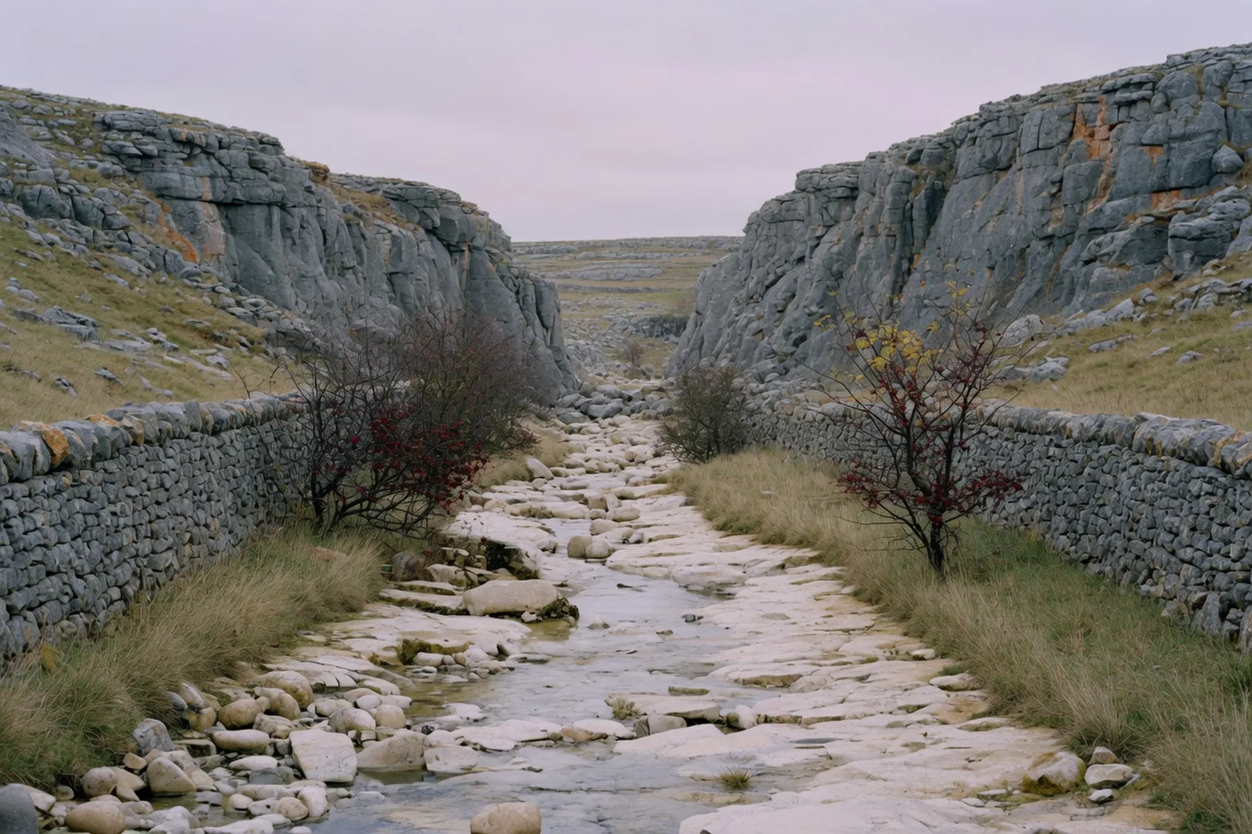
Lathkill Dale is the walk people mean when they want a limestone dale without driving far. It lies about two miles south-west of Bakewell, inside the Peak District National Park, and it rewards the small amount of planning the journey takes. Which village you start from changes what kind of day you get, so this is a dale where the first decision matters.
Lathkill Dale is part of the Derbyshire Dales National Nature Reserve, which Natural England describes as five limestone valleys: Lathkill Dale, Cressbrook Dale, Monk’s Dale, Long Dale and Hay Dale. The whole reserve covers 385 hectares, 87% of it a Site of Special Scientific Interest and just over three-quarters a Special Area of Conservation. The dale itself sits between the villages of Over Haddon, Monyash and Youlgreave. The Limestone Way long-distance path runs through parts of it, and National Cycle Route 68 passes nearby. Lathkill Dale is the walk’s namesake and its reason.
The river that gives the dale its name is not always there. Its upper reach can run dry in normal conditions, which is why Natural England runs a schools activity for the dale literally called “Why the River Disappears” — the vanishing is the signature feature, not folklore. Walk the upper end after a dry spell and the bed is pale, bare stone; come after rain and water moves through it again. In a wet week the change is quick, and the same path reads differently on the way up and the way back. Two visits a month apart can feel like two different dales. Natural England’s page on Derbyshire’s National Nature Reserves is the source to read before you go.
There are three public access points, all listed by Natural England. The car park at Over Haddon is the most common start. A car park at Moor Lane serves the Youlgreave side, and there is roadside parking on the B5055 about half a mile east of Monyash. Most people choose between Over Haddon and Monyash, the two ends of the dale; Youlgreave sits lower in the valley system. The villages themselves are the landmarks; from any of the three points the dale is the obvious descent between the walls. One rule applies everywhere: there are no bridleways in the dale, so horses and bicycles stay out. This is a walking dale.
From Over Haddon, the lower half of the dale runs along a level track. Natural England says it is suitable for wheelchairs and pushchairs, and disabled parking sits near this start, which makes Over Haddon the sensible end for a slow, level day rather than a climb. The track follows the valley floor between dry stone walls, with the crags closing in as you go further up. The dale is linear, not a circuit, so most people walk as far as they like and turn back the way they came. There is no fixed length; it can be an hour’s there-and-back or a full morning, and nothing obliges you to reach the far end.
Starting from the B5055 east of Monyash, you drop into the head of the dale and walk down; the meadows sit at the top. Natural England describes the hay meadows at this end as relatively level, but the real difference is character. This is the drier, stonier reach, the one most likely to be bone-dry, so it is the end to pick for the meadows and the dry riverbed rather than the engineered track. If the weather has been wet, Over Haddon shows you the water; after a dry spell, the Monyash end still reads as a proper limestone dale, the bare stone doing the work the river usually does.
The dale changes with the season more than most walks, and water is the variable. After wet weather the river runs and the stone glints; after a dry spell the upper bed is pale and empty. The hay meadows are at their best in summer, but autumn suits the place — low light on grey crags, thin grass, the hawthorn bare. Winter is quiet and can be very wet underfoot. Come in any month and the walk holds its shape; the crags and the walls do not change with the calendar, only the water, the grass and the number of other walkers do. The when-to-visit guide covers Bakewell’s seasons; the dale follows the same logic with less pavement.
The Over Haddon car park, DE45 1JE, is run by Derbyshire Dales District Council. It is open 24 hours and you pay on entry. The council lists the charges as £2.20 for all day, 8am to 6pm, £6.40 for coaches, and £1.20 for overnight, 6pm to 8am; the council’s own asterisk says a 20p toilet charge is included in those figures. There are 54 spaces, two disabled, one coach bay, a height barrier and toilets. The parking guide covers the town’s car parks; this is the one for the dale. Check the council’s car-park list if the charges have moved.
The bus gets you close, not to the door. High Peak Buses route 58, Macclesfield to Buxton, serves Bakewell and Monyash, with stops at Bakewell Square, All Saints Church and Pickford Villas in Bakewell and the Bulls Head in Monyash. Over Haddon has no bus service. Peak Network fares on the route are £6.00 for a one-day adult ticket and £5.00 under-19, £18.00 adult and £15.00 under-19 for seven days, and £72.00 adult and £60.00 under-19 for 28 days. A closure on the A54 has diverted the 58 via Rainow and Long Hill since late July, with a 58B shuttle covering Burbage; that diversion is scheduled to end on Friday 30 October 2026, so anyone travelling after that should check the route 58 page, because the route may have changed again. This is a no-car option only as far as Monyash, then a walk in.
The nearest rail stations, by Natural England’s reckoning, are Buxton and Matlock. Neither is on the dale’s doorstep, so this is a drive-and-park or bus-and-walk day rather than a train day. Both towns make reasonable halves of a longer trip: the dale in the morning, a town afternoon. Buxton has its own things to do after the station, and Matlock puts you on the Derwent rather than the Wye. Neither shortens the drive to the dale, so if the walk is the point, park at Over Haddon and let the towns wait. The walks guide lists other routes if you want to combine two.
There is nothing in the dale itself — no café, no shop, no toilets beyond the car park. Food and drink sit in the surrounding villages, Over Haddon, Monyash and Youlgreave among them. The bus stop name at Monyash points to one landmark, the Bulls Head; check its hours before you set out rather than walking in hungry. Take water: the dale is a valley, and the climb out at the end of the day is when people notice they brought nothing.
A dale morning pairs well with a Bakewell afternoon in November. The town’s listing at What’s On Bakewell shows the Bakewell Christmas Market on Saturday 14 and Sunday 15 November 2026, with around eighty stalls, and Bakewell Christmas Sparkle on Sunday 29 November at the Agricultural Business Centre, a free family day. The farmers’ market sits on the last Saturday of the month, 31 October and 28 November 2026. The listing itself says events may change or be cancelled, so check What’s On Bakewell and each organiser’s page before you travel rather than trusting these dates. The market-day article covers the regular Monday market.
Limestone is slippery when wet — Natural England flags it explicitly, and it is the warning people actually need. Phone signal is poor or absent in the valley bottoms, and the public telephones are in Over Haddon and Monyash, so do not rely on a map app once you are down. Keep out of the caves and old mine workings. There are no bridleways, so the dale is walking only, no horses, no cycling. Wear boots rather than trainers, and take a layer: the valley holds cold air.