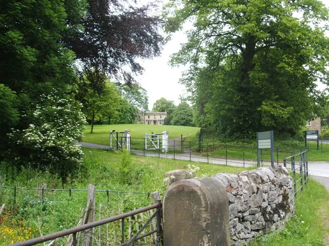
The Peak District was designated in 1951 as the first national park in Britain, and Bakewell is the only town inside its boundary. That is the single most useful fact about the town: everything around it is national park, and the park authority’s headquarters are here.
It covers about 1,440 square kilometres across Derbyshire, Staffordshire, Cheshire and Yorkshire, and it is ringed by Manchester, Sheffield, Derby and Stoke — which makes it one of the most visited national parks in the world by proximity, with something over ten million visitors a year.
The Peak District is not one place. It divides sharply into two, and the difference governs what a walk here feels like.
The White Peak, in the south and centre, is carboniferous limestone: pale drystone walls, close-cropped grass, a plateau cut by deep wooded dales — Lathkill, Monsal, Chee, Dove — with rivers that run clear and sometimes disappear underground. The walking is intimate and enclosed, the flowers in June are exceptional, and Bakewell sits in the middle of it.
The Dark Peak, to the north and along the eastern and western edges, is millstone grit: heather moorland, peat, and long escarpments — the edges — running for miles above the valleys. Kinder Scout, Bleaklow and Stanage are up here. The walking is open, exposed and about the long view.
Bakewell is one of very few bases from which you can do both in a day.
The Peak District became the first national park because of a fight over access.
Through the nineteenth and early twentieth centuries the moors were private grouse shooting land, closed to walkers, and the industrial cities pressed hard against them. On 24 April 1932 a few hundred ramblers, largely from Manchester, staged a mass trespass on Kinder Scout; five were arrested and several imprisoned, and the sentences caused far more outrage than the trespass had.
The campaign that followed produced the National Parks and Access to the Countryside Act 1949, and the Peak District was the first park designated under it. Open access to the moors themselves took another half-century, arriving with the Countryside and Rights of Way Act in 2000.
That history is why the Peak District’s walking culture is what it is, and why the rights of way network here is among the densest in Europe.
The Monsal Trail — thirteen kilometres of former railway, level and traffic-free, through four lit tunnels and over two viaducts. The easiest serious walk in the park.
Lathkill Dale and Bradford Dale — the classic White Peak dales, five kilometres west.
The eastern edges — Baslow, Curbar and Froggatt Edges, and Stanage beyond, for gritstone and long views.
Chatsworth and Haddon Hall — the two great houses, within five kilometres.
Castleton and the Hope Valley — show caverns, Mam Tor and Winnats Pass, twenty-five kilometres north-west.
The Derwent Valley — Cromford Mills and the birthplace of the factory system, a World Heritage Site in its own right, to the south.
It is busy. Ten million visitors a year, concentrated on a handful of honeypots — Castleton, Dovedale, Mam Tor, Monsal Head. Going early and going midweek transforms it.
The roads were built for carts. Peak District lanes are narrow, walled and slow, and they queue at weekends.
Access: open access applies to most of the moorland, and the footpath network covers the rest. Grouse moors may have restricted access on shooting days, which are signed.
Weather: the Dark Peak moors are exposed and serious in winter. The dales are sheltered and usable in almost anything.
Yes — designated in 1951, the first in Britain, under the 1949 Act.
About 1,440 square kilometres, across four counties.
The White Peak is limestone — walls, dales and clear rivers. The Dark Peak is gritstone — heather moor, peat and escarpments. Bakewell sits in the first, within reach of the second.
A mass trespass in 1932 by ramblers demanding access to closed grouse moors. The arrests that followed helped produce the 1949 Act and the national park system.
Yes — it is the only town inside the boundary, and the park authority is based here.