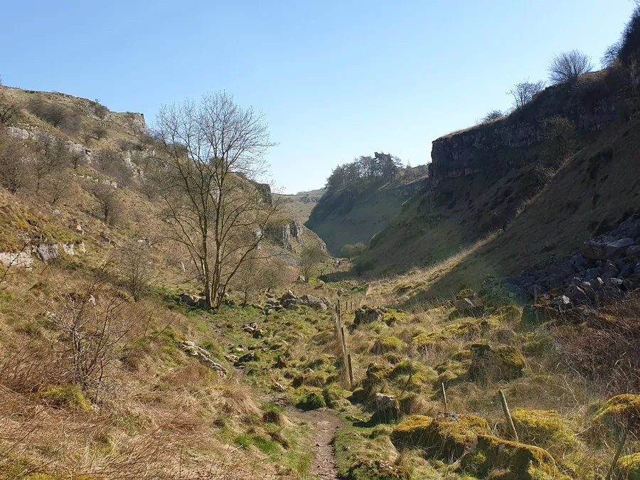
Lathkill Dale runs west from Over Haddon, five kilometres from Bakewell, and it is the dale people mean when they talk about the White Peak. A narrow limestone valley with steep sides, ash and wych elm on the slopes, and the River Lathkill running along the bottom over pale rock and green weed.
It is part of the Derbyshire Dales National Nature Reserve, and it is one of the most botanically important valleys in England.
The Lathkill is a chalk-stream in everything but geology. It emerges from springs below Lathkill Head Cave at the head of the dale, runs clear and shallow over limestone, and in a dry summer it does something disconcerting: it vanishes. The water sinks into the fissured rock and the riverbed runs dry for a stretch, sometimes for hundreds of metres, before the water reappears downstream.
This is normal limestone behaviour and not a sign of anything wrong, though it catches out visitors expecting a river.
The water that does flow is exceptionally clear — clear enough that the Victorians described it as the purest in England — and it supports trout, crayfish and a good deal else.
The standard route runs from the car park at Over Haddon down into the dale and west along the river, with the option of continuing to Monyash at the head, about six kilometres away.
Over Haddon to Lathkill Lodge and back — an easy hour on the valley floor.
Over Haddon to Monyash — around six kilometres one way, with a return by a different route or a bus, and increasingly rocky as you climb towards the head of the dale.
The full circuit with Cales Dale — a side valley on the southern side, adding a steep climb and one of the quietest corners of the Peak District.
Surface: the lower dale is a good path; the upper dale is rocky, uneven and slippery when wet, with loose limestone. It is more demanding than the gradient suggests.
This is what the nature reserve designation is about. The limestone grassland and ash woodland here hold an exceptional flora — early purple orchids, cowslips, globeflower, Jacob’s ladder — the last of these a rare plant for which the Derbyshire dales are a national stronghold. May and June are the months.
The woodland is old and there are water voles on the river, dippers, grey wagtails and, if you are lucky, kingfishers.
The dale was industrial. Lead was mined along it for centuries, and the remains are everywhere once you know what you are looking at: Mandale Mine with its aqueduct pillars and engine house, sough outfalls where mine drainage was channelled into the river, and spoil heaps colonised by lead-tolerant plants that grow nowhere else.
The Bateman’s House ruin, near Lathkill Lodge, sits above a shaft that can be looked down into.
Parking: the car park at Over Haddon, which is charged. Monyash also has parking.
Facilities: a café at Over Haddon; nothing in the dale.
Access: the lower dale from Lathkill Lodge is manageable for a short distance; the rest is not accessible.
Season: May and June for the flowers, autumn for the colour, winter for full water and no one else.
Dogs on leads — this is a nature reserve with grazing stock.
By car: Over Haddon is signposted from the B5055 west of Bakewell, five kilometres out.
On foot from Bakewell: around six kilometres via the Monsal Trail and the lanes, or by field paths.
By bus: limited services to Over Haddon and Monyash; check the timetable.
Yes. In dry weather the Lathkill sinks into the limestone and the bed runs dry for a stretch before the water reappears downstream. It is normal for a limestone river.
An easy hour on the valley floor from Over Haddon, or about six kilometres one way to Monyash on rougher ground.
Only the short stretch near Lathkill Lodge. The upper dale is rocky and uneven.
May and June, when the limestone grassland is at its richest — orchids, cowslips and Jacob’s ladder among them.
Yes. Only the car park at Over Haddon is charged.